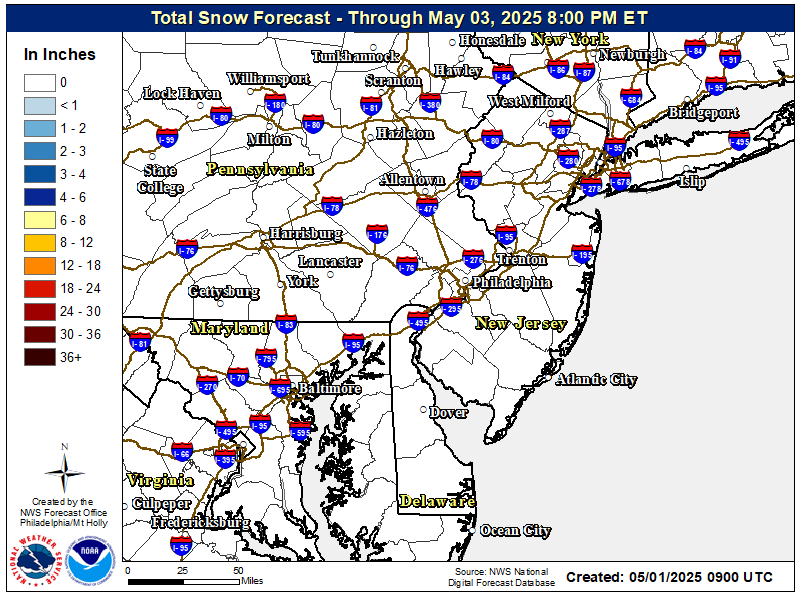
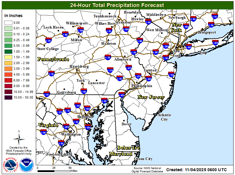
Not worth a thread yet, but the GFS and NAM are now both showing several inches of snow down through the 95 corridor and even to the coast early Monday, as cold air rushes in behind the front, before the precip shuts off. It's an unlikely scenario, which the NWS doesn't buy into (although they didn't see the 18Z models for their 4 pm forecast) since the rest of the models only show some minor to moderate snowfall for places like the Poconos and Catskills and far NWNJ, but stranger things have happened. Worth watching. Still looking at major snowfalls (6-12" or more for some) for the ski resorts in the Adirondacks and interior New England.After a gorgeous day tomorrow, we have a big storm coming Sunday afternoon into early Monday. 2-3" of rain for most (with areas along the shore and east of NYC maybe getting more than 3") and we'll see 20-30 mph winds with gusts to 40 mph for the region and possibly higher gusts at the coast. T-storms look likely too with temps in the low 60s.
A flood watch (for possible urban/stream flooding from rainfall) is up for the region and coastal flood advisories are likely, as are high wind advisories for the coast. Precip will end Monday as some snow well N/W of 95, with big snows (6-12" or more) likely for the ski resorts in the Adirondacks and interior New England.
https://www.weather.gov/phi/
Either way, a big, windy rainstorm with 2-3" of rain for the region is on its way starting tomorrow in the late morning, with the worst of it tomorrow night. Some urban/stream flooding is possible, as is some minor coastal flooding, plus high wind advisories might be needed for gusts up to 50 mph, especially near the coast.
https://www.weather.gov/phi/