Dangerous severe weather event now expected

Hugh's Burner Phone

Well-known member
Aug 3, 2017
3,932
2,592
113
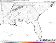
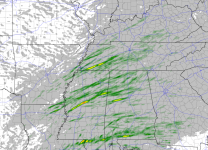
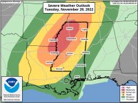
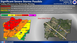
SPC has upgraded parts of western MS to a moderate risk of severe weather starting tomorrow afternoon. In this area long track strong to violent tornadoes are possible as well as straight line winds up to 80mph. The threats decrease slightly outside the moderate risk area, but most of MS needs to stay weather aware for this extremely potent system. Up until last night there was some question of whether or not enough instability would be present to fuel these storms, but it now appears that there will be. High lapse rates and extremely strong wind shear is forecast to be present so this added instability will be enough to make this happen. This will also be a long duration event starting Tuesday afternoon and not ending until well after midnight Wednesday morning. Discrete supercells will develop and quickly go severe and then tornadic as they move across the state. Eventually, a squall line will form and pose more of s wind threat as the best dynamics pull away from the state. Worst case scenario is storms developing over LA early afternoon and then moving across the state during peak daytime heating just before dark.
2147D62C-9283-4198-9927-CDC0447BF121.pngC0E59F8E-F27B-4A8C-8467-63AD5C0DC1BB.png
 
  • Like
Reactions: jethreauxdawg

MagnoliaHunter

Active member
Jan 23, 2007
846
360
63
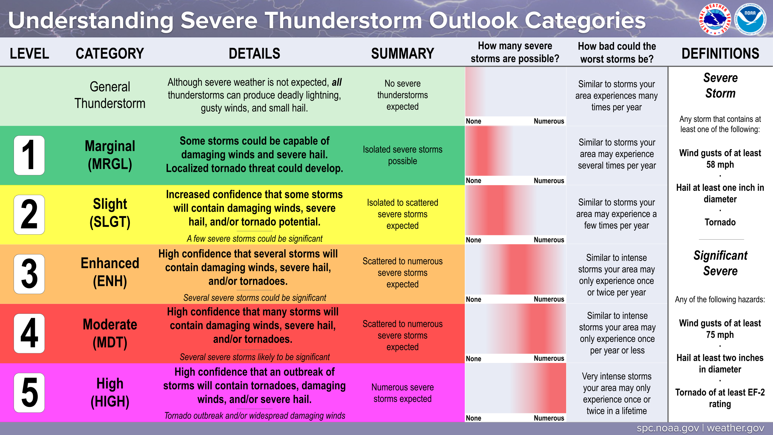
Thanks for all of the updates that you do, but whoever does the maps, needs to redo their legends. I wouldn't call the second highest percentage for tornadoes or damaging winds "moderate".
 

Hugh's Burner Phone

Well-known member
Aug 3, 2017
3,932
2,592
113
Thanks for all of the updates that you do, but whoever does the maps, needs to redo their legends. I wouldn't call the second highest percentage for tornadoes or damaging winds "moderate".
There's been a lot of discussion regarding that with people not realizing that is a very high severe threat. It used to only be marginal, slight, moderate, and high. They went back a few years ago and added enhanced between slight and moderate. But it all comes down to this. This is a graphic and information put out by the SPC that was not intended for general public use. It was designed for use by professional meteorologists only and they knew the distinction. However, all of the TV mets started using it on their broadcasts and then social media sites started using it and it became widely known by the public who may or may not be aware of the severity of the different tier levels. As of right now, the SPC has not shown any indication of wanting to change the nomenclature and fall back to the "people we write it for know what it means".
 

Drebin

Well-known member
Aug 22, 2012
14,981
10,405
113
A Twitter thread from the Memphis office.


Memphis office is notoriously conservative in their wording, so it's at least interesting to me that they're using the "outbreak" language.

Based on what I've seen, it looks like the delta, up through central MS is going to get the brunt of this. All my peeps in and around GTA need to keep a lookout for this one. Also likely to be a nocturnal event, although storms this time of year tend to move much faster.
 

Hugh's Burner Phone

Well-known member
Aug 3, 2017
3,932
2,592
113
For those that are interested, here is what the various threat criteria represent.

 
  • Like
Reactions: IBleedMaroonDawg

thatsbaseball

Well-known member
May 29, 2007
16,022
3,010
113
Hugh, Do you anticipate any significant changes in the forecast between now and tomorrow evening ?
 

Hugh's Burner Phone

Well-known member
Aug 3, 2017
3,932
2,592
113
The moderate risk has been expanded to now cover most of north and central MS. No real changes to thinking although they did mention that low level lapse rates may not be ideal for tornadogenesis, but that is still not certain and several tornadoes are still expected to develop with some possibly being long tracked and strong to violent (EF-3+)


  • Like
Reactions: IBleedMaroonDawg

DesotoCountyDawg

Well-known member
Nov 16, 2005
20,573
6,102
113
Memphis office is notoriously conservative in their wording, so it's at least interesting to me that they're using the "outbreak" language.

Based on what I've seen, it looks like the delta, up through central MS is going to get the brunt of this. All my peeps in and around GTA need to keep a lookout for this one. Also likely to be a nocturnal event, although storms this time of year tend to move much faster.
It’s a bunch of young guns in the Memphis office now. The older forecasters have retired.
 

Hugh's Burner Phone

Well-known member
Aug 3, 2017
3,932
2,592
113
Posting this verbatim from Jackson NWS.

Tuesday-Tuesday night: At the start, significant upper level jet &
strong cold frontal system will be taking shape over the central
Plains. Sfc cyclone of 995mb will be deepening over the central
Plains, quickly ejecting E-NE through the mid-MS Valley by midday
Tues & gaining latitude into the N Great Lakes by Tues evening to
Tues night. Sfc frontal system will be diving SE towards the area by
Tues aftn in the ArkLaTex through the Ozarks & Mid-MS Valley by Tues
evening & sweeping through the area by Wed morning. Strong synoptic
jet of 75-85kts @ 500mb & +125kts @ 300mb downstream jet streak
intensifying into the central Plains Tues in advance of mean trough
ejecting out of the Pacific NW with favorable jet
placement/diffluence in the area. Subtropical ridge will deepen over
the W Carribean, keeping the bulk of the trough/forcing & height
falls well off to the NW. However, significant WAA & moisture
advection will bring boundary layer moisture with dewpoints climbing
into the upper 60s-low 70s across the region. With anomalous warmth
& dewpoints, combination of moderate to significant destabilization
& anomalous mean bulk shear aloft will favor significant severe
weather event. This will lead to combination of significant
kinematics & thermo profiles, some values not seen per SPC sounding
climatology (i.e. MLCAPE around 1000-1500 J/kg) & long clockwise
curved hodographs with +300-400 m2/s2 effective SRH & mean layer
bulk shear around 30-45kts in the 0-1km/0-3km & 50-60kts in the 0-
6km layer. This will continue to support all modes of significant
severe weather, including tornadoes, some strong & long track
tornadoes, damaging winds up to 80mph & large hail of golf ball size
or potentially larger. Highest threat looks to be along & NW of the
Natchez Trace corridor. Storm mode looks to be a combination of mid-
morning warm advection showers growing upscale & developing into
supercell mode into the afternoon hours. There are some challenges
on initial development timing & any southern storms developing
across the region, which could limit some inflow of most efficient
moisture. However, this area in SE MS could have better mid-level
capping & 700mb heights which could suppress some convection into
the Pine Belt. After collaboration with SPC earlier today, the
"Moderate" & "Enhanced" risk areas were expanded to the E & SE into
the Hwy 82/Hwy 45 corridors & along I-20 corridors, while the Slight
was also expanded to include the most S & E extreme portions of the
region. Timing for the most significant severe weather looks to be
in the 6PM to midnight timeframe, with some lingering after midnight
through 4AM. The earlier development is tricky & some severe &
tornado potential are possible as early as mid-morning to early aftn
hours. Kept timing as is for now but confidence beginning of the
warm sector supercells is lower while increased confidence of
decreasing severe potential in the Delta around 8PM-11PM in the NW
Delta, the I-55 corridor around midnight or 1AM & most potential
moved out by just before daybreak in E-SE MS.
 

msstatelp1

Active member
Aug 21, 2012
1,626
403
83
Posting this verbatim from Jackson NWS.

Tuesday-Tuesday night: At the start, significant upper level jet &
strong cold frontal system will be taking shape over the central
Plains. Sfc cyclone of 995mb will be deepening over the central
Plains, quickly ejecting E-NE through the mid-MS Valley by midday
Tues & gaining latitude into the N Great Lakes by Tues evening to
Tues night. Sfc frontal system will be diving SE towards the area by
Tues aftn in the ArkLaTex through the Ozarks & Mid-MS Valley by Tues
evening & sweeping through the area by Wed morning. Strong synoptic
jet of 75-85kts @ 500mb & +125kts @ 300mb downstream jet streak
intensifying into the central Plains Tues in advance of mean trough
ejecting out of the Pacific NW with favorable jet
placement/diffluence in the area. Subtropical ridge will deepen over
the W Carribean, keeping the bulk of the trough/forcing & height
falls well off to the NW. However, significant WAA & moisture
advection will bring boundary layer moisture with dewpoints climbing
into the upper 60s-low 70s across the region. With anomalous warmth
& dewpoints, combination of moderate to significant destabilization
& anomalous mean bulk shear aloft will favor significant severe
weather event. This will lead to combination of significant
kinematics & thermo profiles, some values not seen per SPC sounding
climatology (i.e. MLCAPE around 1000-1500 J/kg) & long clockwise
curved hodographs with +300-400 m2/s2 effective SRH & mean layer
bulk shear around 30-45kts in the 0-1km/0-3km & 50-60kts in the 0-
6km layer. This will continue to support all modes of significant
severe weather, including tornadoes, some strong & long track
tornadoes, damaging winds up to 80mph & large hail of golf ball size
or potentially larger. Highest threat looks to be along & NW of the
Natchez Trace corridor. Storm mode looks to be a combination of mid-
morning warm advection showers growing upscale & developing into
supercell mode into the afternoon hours. There are some challenges
on initial development timing & any southern storms developing
across the region, which could limit some inflow of most efficient
moisture. However, this area in SE MS could have better mid-level
capping & 700mb heights which could suppress some convection into
the Pine Belt. After collaboration with SPC earlier today, the
"Moderate" & "Enhanced" risk areas were expanded to the E & SE into
the Hwy 82/Hwy 45 corridors & along I-20 corridors, while the Slight
was also expanded to include the most S & E extreme portions of the
region. Timing for the most significant severe weather looks to be
in the 6PM to midnight timeframe, with some lingering after midnight
through 4AM. The earlier development is tricky & some severe &
tornado potential are possible as early as mid-morning to early aftn
hours. Kept timing as is for now but confidence beginning of the
warm sector supercells is lower while increased confidence of
decreasing severe potential in the Delta around 8PM-11PM in the NW
Delta, the I-55 corridor around midnight or 1AM & most potential
moved out by just before daybreak in E-SE MS.
Can I get a TL;DR?
 

cling84

Member
Aug 22, 2012
27
34
13
Sounds an awful like when tornadoes went through Brandon in Nov. 1992 and Madison in Nov. 2001. Best pay attention to any supercell storms that form separately from others.