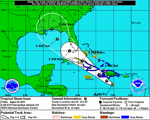
I know its still a ways out but this is the latest forecast run on the European model. Cat 5 on the Gulf Coast. Not good.

"We are pleased to confirm your reservation at Gulf State Park for 3 night(s). We have reserved 1 Off Wtr Back In or PT arriving 08/31/12"
I know its still a ways out but this is the latest forecast run on the European model. Cat 5 on the Gulf Coast. Not good.