It's going to be really rough the next 5 days or so. Expect to see the red flags up and down the shore.
So they've put out alerts because you're visiting? Oh, because of the hurricane!

It's going to be really rough the next 5 days or so. Expect to see the red flags up and down the shore.
Holy rapid intensification Batman! Sharing the link to an incredible visible satellite loop (I hope the link works) of Hurricane Erin from around 8-9 am this morning as it was undergoing explosively rapid intensification from a 75 mph hurricane yesterday at 5 pm to a Cat 3 hurricane of 120 mph at 5 am this morning to a Cat 5 hurricane with 160 mph winds (at 915 mbar central pressure) at 11:20 am this morning. One of the fastest intensifications ever seen, especially before September. Erin has since weakened slightly to a strong Cat 4 storm with 150 mph winds (at 934 mbar), due to undergoing an eyewall replacement cycle, which was expected given how tiny the storm and its eye is (~10 miles across).
https://www.facebook.com/share/v/1BCoXa46hS/
Erin was able to strengthen so quickly due to the combination of anomalously high ocean temps in the Atlantic and very favorable conditions (low shear and minimal dry air). All I can say is that folks along the US east coast and in Bermuda look like they'll be incredibly lucky as Erin's track (see below), which has moved west a bit, is still forecast to have Erin pass about midway between the NC OBX and Bermuda (300+ miles from both points), meaning it's very likely that the only effects for the east coast (including Canada) and Bermuda will be very strong swells, heavy surf, dangerous riptides and beach erosion for much of the coming week (starting by Tuesday for the DE/NJ/NY area). A couple of links below...
https://www.nhc.noaa.gov/graphics_at5.shtml?start#contents
https://www.wunderground.com/.../2025-08-16-major...


You don't portray yourself as an overbearing "helicopter" parent. While I would (and did at 13) certainly have given our son strong warnings about risks of swimming with high rip current risks or when lifeguards were off duty, I can't say I knew exactly where he was all the time at age 13, as we gave him freedom to be on his own within reason.When my boys were 13 I knew exactly where they were. Especially when they were around water. It's called being a good parent.
Not true. Most Cat 5 names are retired, but it's not a "rule" per se. Emily in 2005 and Edith in 1971 were Cat 5's whose names were not retired. One of the major factors is if there is catastrophic damage and/or loss of life and I could see Erin not being retired because there will not be any catastrophic damage.Ehhh it briefly became a cat 5 so it will have its name retired…
I live here. I know what to expect. The warning is for you Bennies.So they've put out alerts because you're visiting? Oh, because of the hurricane!


We better not be trailing by two TDs until late OctoberConcerns about the two trailing potential TDs - hopefully same trajectory as Erin
Actually the one behind Erin is now looking like even more of a fish storm (if it forms - not a given) than Erin is. The one behind that is way too far off to speculate on.Concerns about the two trailing potential TDs - hopefully same trajectory as Erin

 explore.org
We better not be trailing by two TDs until late October
Good - wife on a Caribbean cruise Aug 24-31. Hoping for no hurricanes during that time.....Actually the one behind Erin is now looking like even more of a fish storm (if it forms - not a given) than Erin is. The one behind that is way too far off to speculate on.
The gfs last night had a cane up the coast for the 29-31
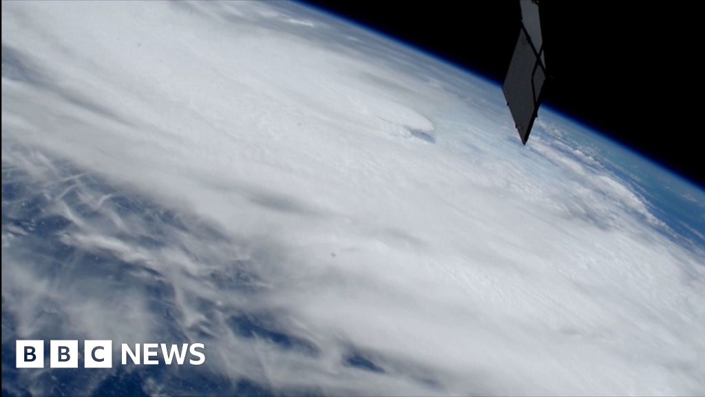
 bbc.com
It was posted on americanwx..that's where I saw itSo, the guy who gives me crap about posting potential snowstorm info 5 days out is now trolling that a tropical wave near Africa, which the NHC currently only gives a 40% chance of even forming into a tropical storm in the next 7 days is going to magically evolve into a hurricane and come up the east coast 10 days from now? When no model shows this? The closest thing I saw on the GFS was a weak storm (no "cane") forming near NC and meandering up the coast, which might not even be tropical and might not even reach TS status if it is - and no other model shows this. If you posted this on AmericanWx you'd be laughed off the board. Again.
 www.americanwx.com
No joy in Mudville?Seems like you are struggling the past 8 months without joy
That's Monday evening's run, not last night's, plus it has not been reproduced by the GFS or any other model. Slapping you around, verbally, for making ridiculously misleading troll posts is simply a public service. That was likely your worst weather post ever and that's saying something. Be better.It was posted on americanwx..that's where I saw it
E PA/NJ/DE Summer 2025 Obs/Discussion
Seems like you are struggling the past 8 months without joy
Good time to check in on the Frying Pan Tower off of NC. Surprised the waves aren't bigger at this point.
Frying Pan camera - live video from Cape Fear | Explore.org
This live ocean cam is situated on a former coast guard observation tower off the coast of North Carolina.
its was a model run that was shown not only on the pa board but the ny board as well. No one made you or your ilk the arbiter of information especially based on your past history from 5 yearsThat's Monday evening's run, not last night's, plus it has not been reproduced by the GFS or any other model. Slapping you around, verbally, for making ridiculously misleading troll posts is simply a public service. That was likely your worst weather post ever and that's saying something. Be better.
You're just not very good at arguing are you? You said it was a GFS run from last night, i.e., Tuesday night, when it was a run from Monday night, so you couldn't even get that right. More importantly, you're being extremely hypocritical in making a ridiculous, unsupported post about a hurricane in our area 10 days from now, which nobody in the world takes seriously, as that's click-bait, when you regularly criticize me for making posts about possible snowstorms even 5 days out - if I had posted what you did you and your whole cabal would be all over it. Do you actually not see the hypocrisy or are you just trolling?its was a model run that was shown not only on the pa board but the ny board as well. No one made you or your ilk the arbiter of information especially based on your past history from 5 years
And it’s actually a beautiful night with all that going on. Not much beach left of what is normally a 50 yard stretchIit's got windy here over the last couple hours. Adding to the fun is we're entering a high tide cycle with or without the storm. Expecting Moderate tidal flooding tomorrow night with minor the next 2 high tides.
Ahhhh, Jersey shore.

Yawn..you sound derangedYou're just not very good at arguing are you? You said it was a GFS run from last night, i.e., Tuesday night, when it was a run from Monday night, so you couldn't even get that right. More importantly, you're being extremely hypocritical in making a ridiculous, unsupported post about a hurricane in our area 10 days from now, which nobody in the world takes seriously, as that's click-bait, when you regularly criticize me for making posts about possible snowstorms even 5 days out - if I had posted what you did you and your whole cabal would be all over it. Do you actually not see the hypocrisy or are you just trolling?
I'm not the "arbiter" of anything. I don't give a crap, usually, what you or others post in weather threads or who starts weather threads (although I and most others do like when thread titles are updated as the situation changes), etc., but I will call you out on your stupidity and hypocrisy every time, because you've earned it.
Another data point proving that name-calling is the last refuge of those who lost the argument and won't admit it.Yawn..you sound deranged
New board, same old ****.RU#'s ==><== bac
Pot meet kettle.Another data point proving that name-calling is the last refuge of those who lost the argument and won't admit it.
He lacks self awarenessPot meet kettle.
Like I've said before, I appreciate a no-agenda weather thread, but that I also get some chuckles from the banter and trash-talking.New board, same old ****.

So moving R opener to Thurs. 8/28 might be a homerun. Appreciate the heads-up!The gfs last night had a cane up the coast for the 29-31
Indeed
Not true. Most Cat 5 names are retired, but it's not a "rule" per se. Emily in 2005 and Edith in 1971 were Cat 5's whose names were not retired. One of the major factors is if there is catastrophic damage and/or loss of life and I could see Erin not being retired because there will not be any catastrophic damage.
Last night around 8pm until i went to bed there was zero breeze, very oddi was going to walk up but couldn't find any bricks to put in my pockets.
It started picking up here 9-10. Going pretty good now. Supposed to get stronger in a few hours then start to die down a bit by eveningLast night around 8pm until i went to bed there was zero breeze, very odd
He uses a line like "your cabal" and then complains about name-calling. And why? Why is there a pissing match at all regarding weather threads? It is insane. Didn't he once leave this board when the other one split off and announce it with a fanfare, stating that he had been invited to move over to the new board? Don't get me wrong, you both have issues.. I just find him much more bizarre.He lacks self awareness
So moving R opener to Thurs. 9/28 might be a homerun. Appreciate the heads-up!