OT: Significant snowstorm on Friday night into Saturday
- Thread starter Mikemarc
- Start date
You are using an out of date browser. It may not display this or other websites correctly.
You should upgrade or use an alternative browser.
You should upgrade or use an alternative browser.
Waiting..............3.5” in Succasunny. Not the 8” I was hoping for/expecting
This is some epic-level whining. Trolling activity in weather threads is a small fraction of what it use to be. Busts are way too common and with the benefits of global warming, winters have been mild for the past several years. Your post is just more evidence of why you get trolled in the first place.Thanks! With my waning interest in RU sports, the weather posts are probably my main activity on this board (other than football gameday threads when we're away, which I still enjoy), but even that's in jeopardy, as I post very similar info in about 5 other places and have about 500 people on an email distribution, so it's a lot of work and this is the only place where I get trolled incessantly and it's getting old (I'm not looking for plaudits, but the vast majority of people elsewhere seem to appreciate the effort, even if the info ends up being wrong sometimes, like for this storm). Although apart from one poster, this thread was quite good, so maybe things will improve here.
^^^^^ Truth!C'mon if it weren't for the ball-busting weather threads here would get maybe half the traffic.
")
See grass in old bridge as well. At most, 1 inchNorthern Monmouth County, I can see grass. Not even an inch.
FYI - bears have been in hibernation in the stock thread for quite a while. Hope you are enjoying this market and making good money. 2026 should be a fun year!See grass in old bridge as well. At most, 1 inch
My thanks to Numbers and BAC for the updates. While I got a couple or few inches less than forecasted the meteorologists nailed the timing and the snow & ice part. Some will call it a bust but does it really matter if I got 3 or 4 inches instead of 6? What matters to me is that they got it right that it would start around 6:00, the roads would be slick, and I should get my snowblower ready.
I should have done just that vs. all the constant prep and updates and holding. Just that my family has struggled to gather for last 4 years. My wife actually cleared off all the tables and stuff pre-set BEFORE I had a chance to even weigh in and contact folks. Spousal stress relief. THAT in itself was worth the cancellation. Just can't win anymore trying to do good deeds lol. HAlf the folks are happy I cancelled. Half are annoyed lol. CHEEERS!I was having a party today, people traveling from Tewkesbury in Hunterdon and Bridgewater. I cancelled it a couple of days ago. That being said I don't know how much the Tewkes or Bridgewater got.
100% Can't do a damn thing with it. I put down 25lbs of salt (and not a big salt guy)..... and just pushed about 100 square feet off the front porch drive. (10 by 10). Impossible.Numbers, thanks for all the thought and effort you put into posting on these storms. Yes, the convergence of weather systems in the NJ/NYC area makers forecasting a bit of a crap shoot.
These storm threads, along with all of the indiv updates and banter, make this my go to storm reporting.
FYI, ended up with 1/2" plus of unshovable frozen sleet/rain in Ringoes NJ.
And even more snow. Since my last measurment of 2.1" I had some errands to run and then I went to Oak Ridge Park and shoveled all the disc golf tee pads (29!), as I'm part of the club there and I enjoy being out in the snow shoveling and walking around. It was snowing the whole time and they went from 2.5" to 2.7" when I was done around 1:00 pm. So I got home and measured again and we got about 0.3" more snow as everything was covered again - bonus! My wife said it was snowing the whole time I was gone and the radar showed the snow - looks like that inverted trough feature some were talking about materialized for much of NJ, even down into SNJ. Anyway I think the final number is now 2.4" (I don't think we'r going to get more), which brings my season total up to 10.1". It's just beautiful out there and despite the bust for our area and most in NJ, I'm pretty happy with the result as it feels like deep winter out there - 28F at midday with snow falling - sweet! Here's a link to the radar summary for the storm through about noon today, which is pretty cool.Well whaddya know? We got another 0.3" since 3 am, bringing my total to 2.1", which somehow sounds like less of a bust than 1.8", lol. Woke up once and saw some light snow and looking at the radar since 3 am I can definitely see another 0.3" (looks like it should've been more, but that's what I measured). Snowing very lightly now at 25F.
Reports of 4-7" on LI, 3-5" for most of NYC including 4.3" in Central Park, breaking their almost 4 year streak without a 4"+ storm (last storm over 4" was 8.3" on 1/28/22, although everyone says they've undermeasured a few times - there's a whole cottage industry on critiquing CPK's snowfall measurements, lol), 3-5" in NENJ (Union up to Bergen), including 4.2" at EWR.
However, I'm not sure anywhere else in NNJ or CNJ got over 3", especially S of 78, apart from NE Middlesex County, as it's the furthest NE part of the NWS-Philly counties; saw a report of 3.2" from Carteret, which is ~8 miles NE of me and reports of 3+" in southern SI, which is 7-8 miles E of me and being NE definitely made a difference.
https://cdn.discordapp.com/attachme...4329a597cc783feeb84f7481585b6415cfea7dd0f007&
Glad we lost to Penn State and did not have to subject ourselves to this:
Would've loved it, but would've liked beating PSU more.
Since it’s a weather thread, do I just hold onto my SNOW, at 20% below its high, or do I add?FYI - bears have been in hibernation in the stock thread for quite a while. Hope you are enjoying this market and making good money. 2026 should be a fun year!
This. Any Rutgers football fan would love being at a Bowl game right now!Would've loved it, but would've liked beating PSU more.
C'mon if it weren't for the ball-busting weather threads here would get maybe half the traffic.
As I said earlier:
Would you two stop agreeing and start bickering again? That's more entertaining!
Would've loved it, but would've liked beating PSU more.

Sarcasm detector needed for this thread.
I'm getting mine calibrated.

Definitely add! Been trading gold futures for the past year, so I need to thank the goldbugs on the board.Since it’s a weather thread, do I just hold onto my SNOW, at 20% below its high, or do I add?
Were you ever going to win completely in that situation?I should have done just that vs. all the constant prep and updates and holding. Just that my family has struggled to gather for last 4 years. My wife actually cleared off all the tables and stuff pre-set BEFORE I had a chance to even weigh in and contact folks. Spousal stress relief. THAT in itself was worth the cancellation. Just can't win anymore trying to do good deeds lol. HAlf the folks are happy I cancelled. Half are annoyed lol. CHEEERS!

I didn;tGot just sleet in the Philly area. No snow. Some rain. Slick morning but roads were good today
I didn't see a post regarding the Washington's Crossing this year. Did it go off?Got just sleet in the Philly area. No snow. Some rain. Slick morning but roads were good today
There was no Crossing this year as the Delaware is too low. I was up there in early November and I've never seen it so low before. The dock for the Durham boats was on a dry river bed. With the recent rains the water was high enough to raise the dock so two boats could be placed in the water but there was no way to cross.I didn;t
I didn't see a post regarding the Washington's Crossing this year. Did it go off?
We still went, to meet up with friends and former neighbors. There are plenty of activities even without the Crossing. Most of us then went to the Washington Crossing Inn for a quick beverage. Still worth the ride!
Summary: The updated NWS snowfall map and updated warnings (pink) and advisories (blue) map are below, with the NWS adding Monmouth, Middlesex and Somerset to the warnings, but really only for the northern parts of these counties where 5-6" is expected vs 3-5" for the southern parts (where sleet will replace some of that snow) - so CNJ is right on the knife's edge of snow vs. sleet. Advisories are up for counties S/SW of the Monmouth to Somerset/Warren swath in NJ/PA for 1-3/2-4" snowfall (Hunterdon/Mercer are forecast to get 2-4" snow/sleet) with at least an inch or so of sleet (and maybe a bit of freezing rain in some locations). For areas from Philly and adjacent SNJ SW-ward, the advisories are for <1" of snow but up to 0.1" of freezing rain. Expect snow to start around 4-6 pm with temps in the upper 20s so the snow will accumulate on all surfaces, and the snow (and sleet for some) will hit heavy from then through about 1-2 am with lighter precip the rest of the overnight through maybe 9-10 am, but probably 80% of the precip falls by 2 am. Further NE, all snow is expected for Warren, Sussex, Morris and all of NENJ from Union up to Bergen, as well as for all of NYC/LI and the Hudson Valley (where the most snow is likely, due to more precip). Most other media sources are showing fairly similar forecasts to the NWS (and similar to what I shared last night).
https://www.weather.gov/phi/winter
https://www.americanwx.com/bb/topic/62460-snow-potential-dec-26-27/page/40/
Details: So, I honestly have no idea what's going to happen with this one (well, not nearly as much as I'd like, lol). If one looks at the low end (10% chance) snowfall map from the NWS, one can see the huge bust potential on snowfall amounts, noting that the difference between the expected snowfall and the low end snowfall maps is mostly sleet, so the impacts will still be there even for the "low end" scenario. The high end scenario (10% chance) only has 2-3" more of snow than the expected scenario so the bust potential is a smaller difference; link to the NWS winter weather page is below. And trying to predict how much warm air comes in between the 700 and 850 mbar levels in the atmosphere several thousand feet up to melt the falling snowflakes, which then refreeze in the sub-32F bottom 2000-3000 feet of the atmospheric column into sleet, is really really difficult. Really.
To illustrate this, just for the Edison area, snowfall amounts across about 10 global and mesoscale models show a range of 3-10" of snow with a mean of about 5-6" (which is what the NWS is predicting), but it needs to be noted that for the models showing low amounts of snow, they do forecast at least 1" or so of sleet, which is equivalent (in mass) to 3" of snow (so 2" of snow and 1" of sleet would be equivalent, in mass, to 5" of snow), so the storm is going to be quite impactful whether it's all snow or half snow/half sleet and while sleet isn't nearly as pretty and doesn't cause visibility issues it's just as difficult to drive on as snow and it melts much more slowly and is just as hard to remove/shovel.
It's also worth noting that the 12Z NAM finally caved to the rest of the models: for 2 days it has shown little snow SW of about Wantage (Sussex Co) to NYC (showing mostly sleet), but with the 12Z run it has several inches of snow SW of that line (the 3" line is Long Valley to Perth Amboy). Also, keep in mind that for most of the region temps will be in the upper 20s when precip starts around 4-6 pm, so any snow (or sleet for some) will rapidly accumulate on all surfaces making for hazardous driving conditions, even on treated surfaces, especially through 10-11 pm when the heaviest precip will be falling. And even tomorrow morning, with much lighter snow (any sleet will change back to snow for most by 5 am) temps will be in the upper 20s, so not much melting will occur during the day (highs will be around 32F for most). Be careful out there, but also try to get out in it and have a little fun - maybe make a snow (or sleet) angel.
View attachment 1094487
View attachment 1094491
View attachment 1094522
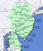
Time for a post-mortem on our snowfall and the NWS forecast and that of most media forecasts, which were generally similar to the NWS's with many even more bullish; there was one forecaster (JDJ Weather Consulting - didn't see his forecast before the storm) who barely busted at all, as he was well below most of the forecasts out there (his forecast is below). Below is the actual snowfall map for the Philly-NJ-NYC region, which is what I focus on in these posts (note that the NWS-Philly covers all NJ counties, except for Union, Essex, Hudson, Passaic and Bergen, which are covered by the NWS-NYC; a map showing the NWS-Philly and NWS-NYC counties is below) and the NWS snowfall forecast map from about 8 am Friday, as I like to gauge the outcome vs. the forecast from 8-12 hours before an event starts, which is what most people tend to make decisions on.
IMO, most of the NWS-Philly counties suffered major forecast busts, which I somewhat arbitrarily define as getting less than half of the low end of the snowfall forecast range, while a few areas suffered moderate forecast busts, which I define as getting below the low end of the forecast range, but more than half of that amount. with the only non-bust exception being Morris County which generally got 3-5" vs. a forecast of 4-7" (a bit low, but wouldn't call that a bust, except for SW Morris which got only 1-3"). Areas that had moderate to major busts (insert jokes or GIFs here) included the following:
- Areas along and a bit south of 195 in NJ and along the PA TPK extension from Philly to Allentown experienced major busts, as they were generally forecast to get 2-3" and these folks all got <1"
- Areas from Philly to LBI and a bit south of there experienced major busts,, as they were forecast to get 1-2" but only got <1/2" with some getting nada
- Areas like Carbon and the Lehigh Valley experienced major busts as they were forecast to get 2-4/3-5" and generally got only 1-2"
- Areas like Sussex/Monroe that generally got 2-4" vs. 4-7" forecasts experienced moderate busts
- Areas between 195 and 78 in NJ (most of CNJ) generally experienced a major bust, as most of the area was forecast to get 3-5", but got mostly <1"" with a few spots getting 1-2". The small exception to this was that the far northern parts of Somerset/Middlesex/Monmouth, which were forecast to get 4-7" got 2-3", which is a moderate bust IMO.
With regard to impact, at least they got the start time correct and the storm was quite impactful on road conditions even for areas that got mostly sleet with some freezing rain, as predicted. In fact, if the forecasters went by frozen mass, the forecasts would've ranged from being decent to maybe moderate busts. For example many locations in the 3-5" forecast areas got 1/2-1" of sleet, which is 1.5-3.0" of snow, by mass, which added to 1/2-1" of snow on top would give 2-4" of snow, by mass (minor bust) vs. the 1-2" snow reported (moderate to major bust).
And personally, my pre-storm forecast of 6.1" for my house was a major bust vs. 2.4" of sleet/snow I got and even vs. the 3.2" of snow-mass (0.4" sleet and 2" snow), but as I said above what we got was only a moderate bust vs. the 4-7" NWS forecast range.


Attachments
-
 1767107387972.png194.4 KB · Views: 1
Last edited: