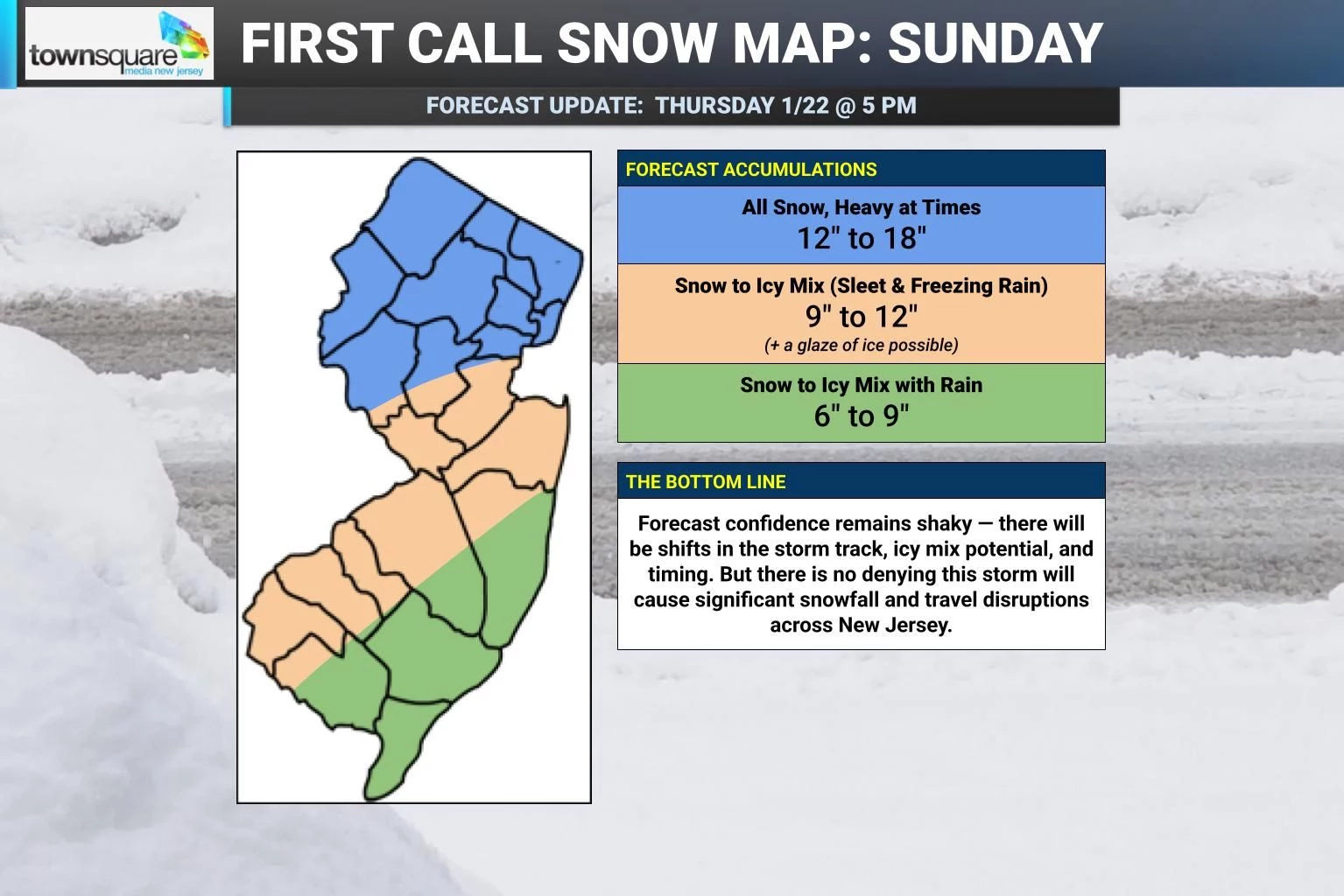
just saw Lees map...much of NJ north of 95 is 6-12...its northwest NJ and morris etc 12 plus also says mixing will cut totals toward monmouth, ocean and coast to south jersey
he says the 12+ line is trending more south today, btw.
just saw Lees map...much of NJ north of 95 is 6-12...its northwest NJ and morris etc 12 plus also says mixing will cut totals toward monmouth, ocean and coast to south jersey
yes you will be fine...the earliest models would have it starting in nj around midnight sat night/sun ..there are others that start it at 9am Sun so its probably somewhere in betweenAny idea on timing for the start of the snow? Might be scoring some tickets to the Knicks at Sixers Saturday at 3pm. I think I'm in the clear but this thing seems to be ever evolving.
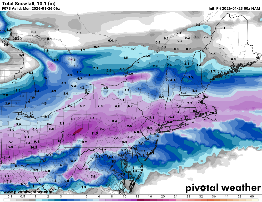
Of course, the weenies are probably humping the GFS' leg right now.GFS is a crush job....a long duration 24 hour event with 10-20 inches area wide....would be the dream scenario for snow weenies...yet its all alone with this solution and never scores a coup
I think they realize what the GFS really is as a model however there is something to be said, its output does match with the mt holly snowfall map currentlyOf course, the weenies are probably humping the GFS' leg right now.
Agree- just kidding. I haven't gone over there. I avoid it when they are in celebratory mode.I think they realize what the GFS really is as a model however there is something to be said, its output does match with the mt holly snowfall map currently

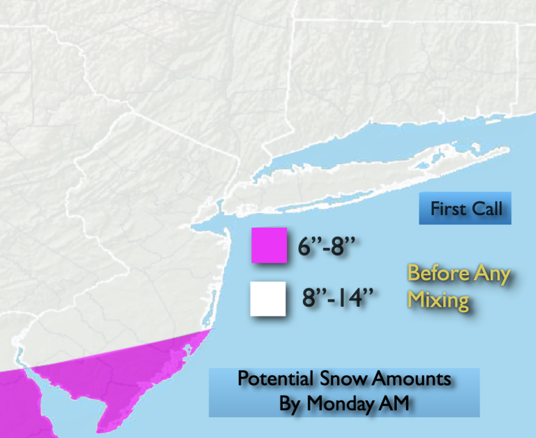
latest from Upton.

I’m an idiot in terms of this, but you may be north of the mixing zone and would get more snow. Not the worst thing as a sleet/frz crust over snow sucks.Just a question for an idiot like me. I see the Sat-Monday temps are all under 26 by me. Why are they forecasting a possibility of a mix and icing? Seems consistently cold and would be all snow.
because there can be warm air aloft and sleet at 25, we had that earlier this year I think the 2nd stormJust a question for an idiot like me. I see the Sat-Monday temps are all under 26 by me. Why are they forecasting a possibility of a mix and icing? Seems consistently cold and would be all snow.

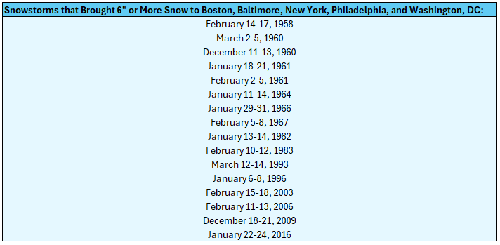
Not to downplay it, but this is getting hyped because we’re not used to storms like this in recent years. We have been through much bigger winter storms than this.Longtime NYC met John Marshall has widespread 8-14
yes and also because they started hyping it last weekend.Not to downplay it, but this is getting hyped because we’re not used to storms like this in recent years. We have been through much bigger winter storms than this.
Just got back from Pennington Shoprite. Still had milk, bread and eggs, but the numbers are dwindling. Hardly any fresh berries which pissed me off. Did get an apple ring off the discount shelf, so I've got that going for me.....Weenie board already discussing how grocery run has already started with bread and milk off the shelves already
The hoarding thing is so ridiculous. If you take advantage of sales and continue to maintain your stock of non perishables, you will not starve. And you’re going to get out in a day or two anyway. Just crazy.Weenie board already discussing how grocery run has already started with bread and milk off the shelves already

Makes sense. Thanks!because there can be warm air aloft and sleet at 25, we had that earlier this year I think the 2nd storm
What storm? We are now officially in WDW until Tuesday.Just got back from Pennington Shoprite. Still had milk, bread and eggs, but the numbers are dwindling. Hardly any fresh berries which pissed me off. Did get an apple ring off the discount shelf, so I've got that going for me.....
")
People will only really be locked in on Sunday but later Monday they can make a quick run to the store by later in the afternoonThe hoarding thing is so ridiculous. If you take advantage of sales and continue to maintain your stock of non perishables, you will not starve. And you’re going to get out in a day or two anyway. Just crazy.