| 02:27 pm EST - 1/25/2026 | Lake Parsippany, NJ | 9.3 |
| 02:27 pm EST - 1/25/2026 | East Meadow, NY | 8.5 |
| 02:08 pm EST - 1/25/2026 | Stony Brook, NY | 7.8 |
| 02:02 pm EST - 1/25/2026 | Greenwich, CT | 8.5 |
| 02:00 pm EST - 1/25/2026 | Park Ridge, NJ | 9.1 |
| 02:00 pm EST - 1/25/2026 | Hoboken, NJ | 8 |
| 01:53 pm EST - 1/25/2026 | East Williston, NY | 9.1 |
| 01:50 pm EST - 1/25/2026 | Mount Arlington, NJ | 10.3 |
| 01:50 pm EST - 1/25/2026 | North Plainfield, NJ | 9.5 |
| 01:50 pm EST - 1/25/2026 | 1 NE North Caldwell, NJ | 9.1 |
| 01:47 pm EST - 1/25/2026 | 1 NW Newark, NJ | 9 |
| 01:46 pm EST - 1/25/2026 | 1 NE Pompton Plains, NJ | 9.5 |
| 01:45 pm EST - 1/25/2026 | Mendham, NJ | 10 |
| 01:45 pm EST - 1/25/2026 | 1 W Bellerose, NY | 9 |
| 01:45 pm EST - 1/25/2026 | Washington Heights, NY | 8.3 |
| 01:44 pm EST - 1/25/2026 | Aberdeen, NJ | 9.8 |
| 01:41 pm EST - 1/25/2026 | Leonia, NJ | 9.2 |
| 01:40 pm EST - 1/25/2026 | Keyport, | 9 |
OT: Tracking Winter Storm Fern 1/25-26
- Thread starter bac2therac
- Start date
You are using an out of date browser. It may not display this or other websites correctly.
You should upgrade or use an alternative browser.
You should upgrade or use an alternative browser.
Yeah that will probably push my total up over 7". It will be interesting to see what model performed best? With so many different forecasts they had I guess we wont know till all official.additional sleet frozen stuff will likely be in the range of 1-1.5 inches for all the areas who stay sleet....should starting winding down by 9 maybe sooner maybe later depending on how quickly the dry slot comes through
...New Jersey...
...Atlantic County...
Buena Vista Twp. 6.7 in 1050 AM 01/25 Trained Spotter
Hammonton 6.0 in 1115 AM 01/25 Public
Atlantic City International 5.9 in 0100 PM 01/25 ASOS
...Burlington County...
Delran 7.0 in 1140 AM 01/25 Public
2 NW South Jersey Regional A 6.6 in 1140 AM 01/25 NWS Employee
Mount Holly WFO 6.6 in 0100 PM 01/25 Official NWS Obs
Tabernacle 6.5 in 1130 AM 01/25 Trained Spotter
1 NNE Rancocas 6.3 in 1245 PM 01/25 NWS Employee
Leisuretowne 4.7 in 0125 PM 01/25 Trained Spotter
Fort Dix 4.5 in 1030 AM 01/25 Public
...Camden County...
Mt. Ephraim 7.0 in 1140 AM 01/25 Trained Spotter
Lindenwold 5.8 in 1115 AM 01/25 Trained Spotter
Cherry Hill 5.0 in 1200 PM 01/25 Public
Haddon Township 4.7 in 1025 AM 01/25 Trained Spotter
...Cape May County...
Ocean City 6.0 in 1130 AM 01/25 Trained Spotter
Cape May 5.0 in 0945 AM 01/25 Public
...Gloucester County...
Pitman 7.0 in 1125 AM 01/25 Trained Spotter
Malaga 7.0 in 0100 PM 01/25 Trained Spotter
Woodbury 4.5 in 1030 AM 01/25 Public
...Hunterdon County...
Bloomsbury 7.0 in 1241 PM 01/25 Public
...Mercer County...
Trenton Mercer Airport 7.2 in 0100 PM 01/25 ASOS
...Middlesex County...
1 SW Browntown 8.3 in 1243 PM 01/25 Public
2 WNW Edison 7.5 in 1206 PM 01/25 Public
Edison 7.5 in 1240 PM 01/25 Newspaper
South River 7.0 in 1200 PM 01/25 Trained Spotter
East Brunswick 6.0 in 1135 AM 01/25 Trained Spotter
...Monmouth County...
Keyport 9.0 in 0140 PM 01/25 Trained Spotter
Tinton Falls 8.1 in 0154 PM 01/25 Broadcast Media
Long Branch 7.0 in 1200 PM 01/25 Public
Howell 6.4 in 1130 AM 01/25 Public
...Morris County...
Mount Arlington 9.5 in 0100 PM 01/25 Trained Spotter
3 NNE Boonton Twp 9.0 in 1233 PM 01/25 Public
Parsippany 6.5 in 1225 PM 01/25 Public
Mendham 5.8 in 1108 AM 01/25 Trained Spotter
Budd Lake 5.2 in 1015 AM 01/25 Trained Spotter
...Ocean County...
Bayville 8.0 in 0130 PM 01/25 Trained Spotter
Toms River 6.4 in 1137 AM 01/25 Public
Brick 6.0 in 1210 PM 01/25 Trained Spotter
Forked River 6.0 in 1240 PM 01/25 Trained Spotter
Little Egg Harbor Twp 5.0 in 1250 PM 01/25 Public
...Somerset County...
Bridgewater 11.0 in 0100 PM 01/25 Trained Spotter
Hillsborough Twp 8.5 in 0100 PM 01/25 Trained Spotter
Middlebush 7.5 in 0130 PM 01/25 Trained Spotter
Somerville 7.5 in 0130 PM 01/25 Trained Spotter
1 NW Lyons 6.9 in 0115 PM 01/25 Cocorahs
...Sussex County...
Sparta 9.6 in 1205 PM 01/25 Trained Spotter
Hopatcong 8.3 in 1245 PM 01/25 Trained Spotter
4 WSW Wantage Twp 6.0 in 1110 AM 01/25 Trained Spotter
...Warren County...
Blairstown 7.2 in 1200 PM 01/25 Trained Spotter
Washington 7.0 in 1125 AM 01/25 Public
Washington 6.5 in 1200 PM 01/25 Trained Spotter
Don't do that. Do this and also leave the doors open under the sink.Yeah, this terrifies me. Getting into the low single digits makes me want to shut off the water entirely before going to bed.

I live in Basking Ridge the GOAT and can confirm 11 as well. I measured an hour ago.that 11 inch report in Bridgewater looks dubious given all the other report
01:40 pm EST - 1/25/2026 Keyport, 9 01:30 pm EST - 1/25/2026 Middlebush, NJ 7.5 01:30 pm EST - 1/25/2026 Somerville, NJ 7.5 01:20 pm EST - 1/25/2026 1 SE Millburn, NJ 6.8 01:15 pm EST - 1/25/2026 1 NE Union, NJ 7.5 01:15 pm EST - 1/25/2026 1 NW Lyons, NJ 6.9 01:00 pm EST - 1/25/2026 Bridgewater, NJ 11 01:00 pm EST - 1/25/2026 Hillsborough Twp, NJ 8.5 01:00 pm EST - 1/25/2026 Newark Airport, NJ 8 01:00 pm EST - 1/25/2026 Trenton Mercer Airport, NJ 7.2 12:40 pm EST - 1/25/2026 Edison, NJ 7.5
Where do you get these reports?that 11 inch report in Bridgewater looks dubious given all the other report
01:40 pm EST - 1/25/2026 Keyport, 9 01:30 pm EST - 1/25/2026 Middlebush, NJ 7.5 01:30 pm EST - 1/25/2026 Somerville, NJ 7.5 01:20 pm EST - 1/25/2026 1 SE Millburn, NJ 6.8 01:15 pm EST - 1/25/2026 1 NE Union, NJ 7.5 01:15 pm EST - 1/25/2026 1 NW Lyons, NJ 6.9 01:00 pm EST - 1/25/2026 Bridgewater, NJ 11 01:00 pm EST - 1/25/2026 Hillsborough Twp, NJ 8.5 01:00 pm EST - 1/25/2026 Newark Airport, NJ 8 01:00 pm EST - 1/25/2026 Trenton Mercer Airport, NJ 7.2 12:40 pm EST - 1/25/2026 Edison, NJ 7.5
What site gives these totals Bac?
02:27 pm EST - 1/25/2026 Lake Parsippany, NJ 9.3 02:27 pm EST - 1/25/2026 East Meadow, NY 8.5 02:08 pm EST - 1/25/2026 Stony Brook, NY 7.8 02:02 pm EST - 1/25/2026 Greenwich, CT 8.5 02:00 pm EST - 1/25/2026 Park Ridge, NJ 9.1 02:00 pm EST - 1/25/2026 Hoboken, NJ 8 01:53 pm EST - 1/25/2026 East Williston, NY 9.1 01:50 pm EST - 1/25/2026 Mount Arlington, NJ 10.3 01:50 pm EST - 1/25/2026 North Plainfield, NJ 9.5 01:50 pm EST - 1/25/2026 1 NE North Caldwell, NJ 9.1 01:47 pm EST - 1/25/2026 1 NW Newark, NJ 9 01:46 pm EST - 1/25/2026 1 NE Pompton Plains, NJ 9.5 01:45 pm EST - 1/25/2026 Mendham, NJ 10 01:45 pm EST - 1/25/2026 1 W Bellerose, NY 9 01:45 pm EST - 1/25/2026 Washington Heights, NY 8.3 01:44 pm EST - 1/25/2026 Aberdeen, NJ 9.8 01:41 pm EST - 1/25/2026 Leonia, NJ 9.2 01:40 pm EST - 1/25/2026 Keyport, 9
...New Jersey...
...Bergen County...
Leonia 9.2 in 0141 PM 01/25 Public
1 NNW Cliffside Park 9.0 in 0133 PM 01/25 Public
1 N River Vale 9.0 in 0115 PM 01/25 Trained Spotter
2 NNE Franklin Lakes 7.6 in 1219 PM 01/25 Trained Spotter
1 SSW River Edge 7.5 in 1235 PM 01/25 Cocorahs
1 SSE Fair Lawn 7.3 in 0120 PM 01/25
1 NNW Cliffside Park 7.2 in 1231 PM 01/25 Public
1 NE Ridgefield 6.5 in 1250 PM 01/25 Public
1 S Fair Lawn 5.5 in 1215 PM 01/25 Trained Spotter
1 WSW Wallington 5.4 in 1123 AM 01/25 Trained Spotter
Fair Lawn 4.0 in 1111 AM 01/25 Trained Spotter
...Essex County...
1 E North Caldwell 9.4 in 0123 PM 01/25 Amateur Radio
1 NE North Caldwell 9.1 in 0150 PM 01/25 Public
1 NW Newark 9.0 in 0147 PM 01/25 Public
1 W North Caldwell 8.5 in 0100 PM 01/25 Cocorahs
1 NW Newark 8.1 in 0102 PM 01/25 Public
1 WNW Bloomfield 8.0 in 0120 PM 01/25
1 NE North Caldwell 8.0 in 1255 PM 01/25
1 SE Millburn 6.8 in 0120 PM 01/25 Public
1 SE Montclair 6.5 in 1153 AM 01/25 Public
...Hudson County...
1 ENE Jersey City 7.1 in 0107 PM 01/25 Public
Harrison 6.0 in 1156 AM 01/25 CO-OP Observer
1 W Hoboken 5.1 in 1151 AM 01/25 Trained Spotter
...Passaic County...
1 S Pompton Lakes 9.5 in 0146 PM 01/25 Trained Spotter
2 NE Wayne 8.2 in 1249 PM 01/25 Public
Passaic 6.5 in 1205 PM 01/25 Public
...Union County...
Newark Airport 8.0 in 0100 PM 01/25 Official NWS Obs
1 SSW Westfield 7.7 in 1232 PM 01/25 Public
1 NE Union 7.5 in 0115 PM 01/25 Trained Spotter
1 WNW Elizabeth 5.2 in 1145 AM 01/25 Public
...New York...
...Kings County...
Sheepshead Bay 8.1 in 1248 PM 01/25 Public
2 NNE Bay Ridge 8.0 in 1245 PM 01/25 Public
1 SSE Williamsburg 6.0 in 1209 PM 01/25 Public
3 NW Flatbush 5.6 in 1123 AM 01/25 Public
1 N Bay Ridge 4.0 in 1117 AM 01/25 Public
...Nassau County...
Matinecock 9.2 in 1245 PM 01/25 Public
East Williston 9.1 in 0153 PM 01/25 Public
1 N Syosset 8.6 in 0130 PM 01/25 Trained Spotter
1 E East Meadow 8.0 in 0139 PM 01/25 Public
1 SW Matinecock 7.0 in 1233 PM 01/25 Public
1 N Syosset 6.6 in 1230 PM 01/25 Trained Spotter
1 ENE Glen Cove 6.0 in 1107 AM 01/25 Public
1 ENE East Meadow 5.8 in 0110 PM 01/25 Emergency Mngr
1 WNW Glen Head 5.7 in 1115 AM 01/25 Public
1 WSW Levittown 5.3 in 1200 PM 01/25 NWS Employee
Carle Place 4.9 in 1145 AM 01/25 Amateur Radio
1 E Searingtown 3.5 in 1100 AM 01/25 Trained Spotter
Seaford 3.0 in 1234 PM 01/25 Public
Roosevelt 2.5 in 1100 AM 01/25 Trained Spotter
...New York (Manhattan) County...
Washington Heights 8.3 in 0145 PM 01/25 Public
Central Park 7.2 in 0100 PM 01/25 Official NWS Obs
...Orange County...
1 SSW Middletown 8.2 in 1230 PM 01/25 Fire Dept/Rescue
1 NNE Chester 7.0 in 1228 PM 01/25 Public
Highland Mills 7.0 in 1200 PM 01/25 Trained Spotter
Cornwall on Hudson 6.5 in 1215 PM 01/25 Trained Spotter
3 SSW Pine Bush 6.0 in 1254 PM 01/25 Public
Warwick 6.0 in 1100 AM 01/25 NWS Employee
Florida 5.5 in 1125 AM 01/25 Trained Spotter
Middletown 5.0 in 1130 AM 01/25 Trained Spotter
Montgomery 4.0 in 1107 AM 01/25 Trained Spotter
Newburgh 4.0 in 1156 AM 01/25 Trained Spotter
...Putnam County...
2 W Putnam Valley 7.3 in 0115 PM 01/25 Trained Spotter
Mahopac 7.0 in 0135 PM 01/25 Amateur Radio
...Queens County...
1 W Bellerose 9.0 in 0145 PM 01/25 Trained Spotter
1 ESE Fresh Meadows 7.1 in 0131 PM 01/25 Public
NYC/La Guardia 7.1 in 0100 PM 01/25 Official NWS Obs
2 S Elmhurst 6.0 in 1255 PM 01/25 Public
NYC/JFK 6.0 in 0100 PM 01/25 Official NWS Obs
2 NNW Greenpoint 4.3 in 1120 AM 01/25 Public
Sleet-rain now in Allenwood/Wall/Herbertsville. Hardly any accumulation since our 12:45 shoveling- less than an inch. Had been using the leaf blower to blow off the steps and trash cans, and that is not working with the sleet-rain.
The nam led the way with warm nose but its maps wrong because of high ratio and it doesnt count sleetYeah that will probably push my total up over 7". It will be interesting to see what model performed best? With so many different forecasts they had I guess we wont know till all official.
Other models like euro and ukie never had warm nose and totals too high south of 78
Gfs a total disaster had 12-16 all week then went 4-6 yesterday then went back to 9-14 at last minute..laughable
Good take by Tomer. No need for the guy in his own silly echo chamber and locale to make childish comments about predictions. Anyone paying attention to the variables in the forecast details and the warm air aloft would have realized that precise predictions were not possible.The nam did well and led the way on the warm nose but its snow maps underperformed as initial ratios were high dumping 6-9 before changeover instead of 5-6
...New Jersey...
...Atlantic County...
Buena Vista Twp. 6.7 in 1050 AM 01/25 Trained Spotter
Hammonton 6.0 in 1115 AM 01/25 Public
Atlantic City International 5.9 in 0100 PM 01/25 ASOS
...Burlington County...
Delran 7.0 in 1140 AM 01/25 Public
2 NW South Jersey Regional A 6.6 in 1140 AM 01/25 NWS Employee
Mount Holly WFO 6.6 in 0100 PM 01/25 Official NWS Obs
Tabernacle 6.5 in 1130 AM 01/25 Trained Spotter
1 NNE Rancocas 6.3 in 1245 PM 01/25 NWS Employee
Leisuretowne 4.7 in 0125 PM 01/25 Trained Spotter
Fort Dix 4.5 in 1030 AM 01/25 Public
...Camden County...
Mt. Ephraim 7.0 in 1140 AM 01/25 Trained Spotter
Lindenwold 5.8 in 1115 AM 01/25 Trained Spotter
Cherry Hill 5.0 in 1200 PM 01/25 Public
Haddon Township 4.7 in 1025 AM 01/25 Trained Spotter
...Cape May County...
Ocean City 6.0 in 1130 AM 01/25 Trained Spotter
Cape May 5.0 in 0945 AM 01/25 Public
...Gloucester County...
Pitman 7.0 in 1125 AM 01/25 Trained Spotter
Malaga 7.0 in 0100 PM 01/25 Trained Spotter
Woodbury 4.5 in 1030 AM 01/25 Public
...Hunterdon County...
Bloomsbury 7.0 in 1241 PM 01/25 Public
...Mercer County...
Trenton Mercer Airport 7.2 in 0100 PM 01/25 ASOS
...Middlesex County...
1 SW Browntown 8.3 in 1243 PM 01/25 Public
2 WNW Edison 7.5 in 1206 PM 01/25 Public
Edison 7.5 in 1240 PM 01/25 Newspaper
South River 7.0 in 1200 PM 01/25 Trained Spotter
East Brunswick 6.0 in 1135 AM 01/25 Trained Spotter
...Monmouth County...
Keyport 9.0 in 0140 PM 01/25 Trained Spotter
Tinton Falls 8.1 in 0154 PM 01/25 Broadcast Media
Long Branch 7.0 in 1200 PM 01/25 Public
Howell 6.4 in 1130 AM 01/25 Public
...Morris County...
Mount Arlington 9.5 in 0100 PM 01/25 Trained Spotter
3 NNE Boonton Twp 9.0 in 1233 PM 01/25 Public
Parsippany 6.5 in 1225 PM 01/25 Public
Mendham 5.8 in 1108 AM 01/25 Trained Spotter
Budd Lake 5.2 in 1015 AM 01/25 Trained Spotter
...Ocean County...
Bayville 8.0 in 0130 PM 01/25 Trained Spotter
Toms River 6.4 in 1137 AM 01/25 Public
Brick 6.0 in 1210 PM 01/25 Trained Spotter
Forked River 6.0 in 1240 PM 01/25 Trained Spotter
Little Egg Harbor Twp 5.0 in 1250 PM 01/25 Public
...Somerset County...
Bridgewater 11.0 in 0100 PM 01/25 Trained Spotter
Hillsborough Twp 8.5 in 0100 PM 01/25 Trained Spotter
Middlebush 7.5 in 0130 PM 01/25 Trained Spotter
Somerville 7.5 in 0130 PM 01/25 Trained Spotter
1 NW Lyons 6.9 in 0115 PM 01/25 Cocorahs
...Sussex County...
Sparta 9.6 in 1205 PM 01/25 Trained Spotter
Hopatcong 8.3 in 1245 PM 01/25 Trained Spotter
4 WSW Wantage Twp 6.0 in 1110 AM 01/25 Trained Spotter
...Warren County...
Blairstown 7.2 in 1200 PM 01/25 Trained Spotter
Washington 7.0 in 1125 AM 01/25 Public
Washington 6.5 in 1200 PM 01/25 Trained Spotter
Surprisingly low number for Atlantic City from my perspective. After shoveling for 3 hours (my house and neighbor's) I think we had an even coating of about 10". Heavy as heck, I'm beat at the moment...
When will you have to go out? All-Nighter?its about 8 or so
Good luck kid.
Snow service reported 6 inches removed. Now the sleet and freezing rain. But this was 2 hours ago?its about 8 or so
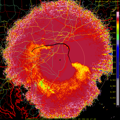
I have no idea what I'm looking at. Did you just try to sneak in a Jackson Pollock painting on us?
I went out at about 12:30 to knock snow off the roof of my Subaru SUV here in Cherry Hill. When I went out again at 3:15, there was no trace of my footsteps from earlier.
Good take by Tomer. No need for the guy in his own silly echo chamber and locale to make childish comments about predictions. Anyone paying attention to the variables in the forecast details and the warm air aloft would have realized that precise predictions were not possible.
Tomer nailed it
DriftingAt the beach.
Why it's hard to tell how much has fallen. In my driveway a small part is down to pavement while at a 2nd location, it's almost 7"
Not til it ends..we have less acounts so wont be too badWhen will you have to go out? All-Nighter?
Good luck kid.
Thanks for these updates and appreciate the time Bac numbers and others put in.
I just cleared my driveway in Morris County is it worth doing another round tonight or just waiting until morning?
I just cleared my driveway in Morris County is it worth doing another round tonight or just waiting until morning?
| 03:53 pm EST - 1/25/2026 | Nazareth, PA | 10 |
| 03:44 pm EST - 1/25/2026 | 1 SE Hartsdale, NY | 12.5 |
| 03:40 pm EST - 1/25/2026 | Flemington, NJ | 10 |
| 03:30 pm EST - 1/25/2026 | Eagleville, PA | 6.7 |
| 03:22 pm EST - 1/25/2026 | Bedminster, PA | 9.2 |
| 03:07 pm EST - 1/25/2026 | 1 N Bay Ridge, NY | 8.4 |
| 03:06 pm EST - 1/25/2026 | 1 SW Bedford-Stuyvesant, NY | 9.5 |
| 03:01 pm EST - 1/25/2026 | Leonia, NJ | 11 |
| 03:01 pm EST - 1/25/2026 | 1 SE Williamsburg, NY | 9.7 |
| 03:00 pm EST - 1/25/2026 | Hillsborough Twp, NJ | 10 |
| 03:00 pm EST - 1/25/2026 | 1 W North Caldwell, NJ | 9.5 |
| 03:00 pm EST - 1/25/2026 | Bath, PA | 9.5 |
| 03:00 pm EST - 1/25/2026 | Mercerville, NJ | 9 |
| 03:00 pm EST - 1/25/2026 | Plainsboro Township, NJ | 8 |
| 03:00 pm EST - 1/25/2026 | Ewing, NJ | 8 |
| 03:00 pm EST - 1/25/2026 | Hamilton Twp, NJ | 7.5 |
| 03:00 pm EST - 1/25/2026 | Kendall Park, NJ | 6 |
| 02:57 pm EST - 1/25/2026 | 1 NE North Caldwell, NJ | 9.4 |
| 02:56 pm EST - 1/25/2026 | 1 SW North Caldwell, NJ | 10 |
| 02:53 pm EST - 1/25/2026 | 1 N River Vale, NJ | 10 |
I think we are now into the territory of this being the biggest snowfall I've seen since I moved to pompton lakes in 2014. still falling at a very heavy rate and all snow. I just shelled out an enormous sum to have my driveway and sidewalks done and im still going to have another 4-5 inches at least to shovel before it's done
Seems like a good link to check snow totals in your area
The NWS in Mount Holly updated its winter weather warning at 3:40. It forecasts "heavy mixed precipitation" with "additional snow and sleet accumulations up to 3 inches and ice accumulations up to .1" inch." The warning continues to last until 1 p.m. tomorrow. As with the previous warning, this one covers all of New Jersey except for the shore counties from Monmouth south and the northern counties border NY and PA.
https://forecast.weather.gov/showsi...Winter+Storm+Warning&lat=39.8949&lon=-74.9722
New York NWS has not updated its warning from the one it issued at 2 p.m.
The local forecast for my Cherry Hill zip code is not consistent with the warning. We are forecast to have sleet until 5 and then sleet/freezing rain. In the evening, the NWS forecasts freezing rain with perhaps some sleet until 4 a.m., then a slight chance of sleet followed by a slight chance of snow. There will be an ice accumulation , according to the NWS, of up to .2."
That's a useful and interesting graph, but would be better if you could filter the results to show data points for only similar times. As it is, the data points are from all over the place w/ regard to time of observationSeems like a good link to check snow totals in your area
Thinking we are 8-10 in No. Plfd, but tough to tell with some of it blowing around. Surprisingly, the snow on my car wasn’t too tough to clean off. Lighter than I thought despite the sleet and no crust on top. Initial snow must have been light as hell.
I saw a 9.5 somewhere for No Plainfield so you are correctThinking we are 8-10 in No. Plfd, but tough to tell with some of it blowing around. Surprisingly, the snow on my car wasn’t too tough to clean off. Lighter than I thought despite the sleet and no crust on top. Initial snow must have been light as hell.
I haven’t seen a snowflake on the JC/Hoboken border for hours now. I’d say at least three hours. Lots of sleet.
How much do you haveI haven’t seen a snowflake on the JC/Hoboken border for hours now. I’d say at least three hours. Lots of sleet.
Just had dreaded snow plow go by and leave 2 foot pile of white lead in front of driveway
I was out earlier and I’m guessing 7 inches to 8 inches. I live in a wind tunnel so little hard to check in my area.How much do you have
Ah yes, nice boulder chunks that freeze solid and form a wall. Love it! Love Winter!Just had dreaded snow plow go by and leave 2 foot pile of white lead in front of driveway

This is kind of funny because Mercerville is smack in the middle of Hamilton Township and at the same time you’re getting a 9 inch report from Mercerville BUT only a 7 1/2 inch from Hamilton Township. Very large township, square mile-wise, so I guess not too surprising?
03:53 pm EST - 1/25/2026 Nazareth, PA 10 03:44 pm EST - 1/25/2026 1 SE Hartsdale, NY 12.5 03:40 pm EST - 1/25/2026 Flemington, NJ 10 03:30 pm EST - 1/25/2026 Eagleville, PA 6.7 03:22 pm EST - 1/25/2026 Bedminster, PA 9.2 03:07 pm EST - 1/25/2026 1 N Bay Ridge, NY 8.4 03:06 pm EST - 1/25/2026 1 SW Bedford-Stuyvesant, NY 9.5 03:01 pm EST - 1/25/2026 Leonia, NJ 11 03:01 pm EST - 1/25/2026 1 SE Williamsburg, NY 9.7 03:00 pm EST - 1/25/2026 Hillsborough Twp, NJ 10 03:00 pm EST - 1/25/2026 1 W North Caldwell, NJ 9.5 03:00 pm EST - 1/25/2026 Bath, PA 9.5 03:00 pm EST - 1/25/2026 Mercerville, NJ 9 03:00 pm EST - 1/25/2026 Plainsboro Township, NJ 8 03:00 pm EST - 1/25/2026 Ewing, NJ 8 03:00 pm EST - 1/25/2026 Hamilton Twp, NJ 7.5 03:00 pm EST - 1/25/2026 Kendall Park, NJ 6 02:57 pm EST - 1/25/2026 1 NE North Caldwell, NJ 9.4 02:56 pm EST - 1/25/2026 1 SW North Caldwell, NJ 10 02:53 pm EST - 1/25/2026 1 N River Vale, NJ 10
Damn pile so high Jon was on top of itAh yes, nice boulder chunks that freeze solid and form a wall. Love it! Love Winter!


You in Hamilton NUTS? I noticed that too. I measured around 6” around 1pm. Since then the sleet has been coming down good. Maybe around 2” worthThis is kind of funny because Mercerville is smack in the middle of Hamilton Township and at the same time you’re getting a 9 inch report from Mercerville BUT only a 7 1/2 inch from Hamilton Township. Very large township, square mile-wise, so I guess not too surprising?